
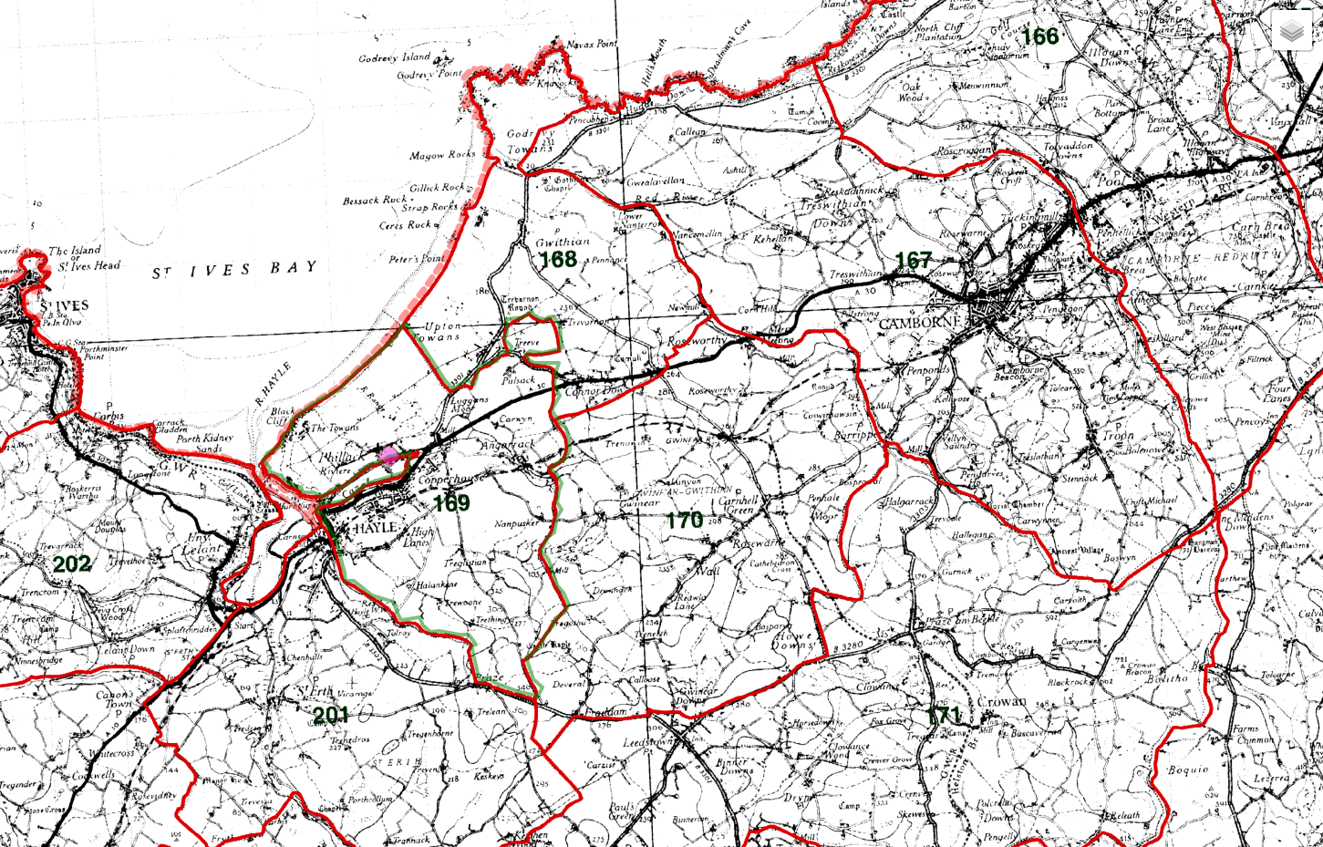
St Erth (boundary)
St Erth
Cornwall
Location Type
Parish Boundary (K&O)
Gazetteer Precision
Exact
Leaflet Map data © openstreetmap.org
OS Grid Reference
SW562347
Parent place
Primary entry for place node
✖
Parish
St Erth
Notes
- AREA : 16328143
- PERIMETER : 22394.785
- PAR1851_ : 22681
- PAR1851_ID : 1848
- NUM : 06/201
- X_COORD : 156217.75
- Y_COORD : 34521.168
- ERROR_TYPE : 0
- REC : 06201
- PLA : ST ERTH
- CAT : P
- PAR : ST ERTH
- APL : -
- NGR : SW566344
- ONP : 189
- CEN : 311.1.1
- CEN_ASTRSK :
- SCE : T
- REF : PRO IR 30/6/50
- COM : -
- NGR_X : 156600
- NGR_Y : 34400
- GAZ_CNTY : CORNWALL
[https://www.genuki.org.uk/gaz/CON/boundary/22681
https://archive.ph/wip/zfPQk]
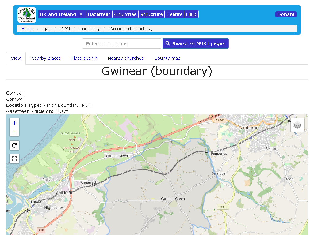
Gwinear (boundary)
Gwinear
Cornwall
Location Type
Parish Boundary (K&O)
Gazetteer Precision
Exact
Leaflet Map data © openstreetmap.org
OS Grid Reference
SW609371
Parent place
Primary entry for place node
✖
Parish
Gwinear
Notes
- AREA : 18643314
- PERIMETER : 21011.664
- PAR1851_ : 22671
- PAR1851_ID : 1815
- NUM : 06/170
- X_COORD : 160905.375
- Y_COORD : 37165.516
- ERROR_TYPE : 0
- REC : 06170
- PLA : GWINEAR
- CAT : P
- PAR : GWINEAR
- APL : -
- NGR : SW611371
- ONP : 189
- CEN : 310.5.1
- CEN_ASTRSK :
- SCE : T
- REF : PRO IR 30/6/70
- COM : -
- NGR_X : 161100
- NGR_Y : 37100
- GAZ_CNTY : CORNWALL
[via https://www.genuki.org.uk/gaz/CON/boundary/22671
https://archive.ph/U1fhg]
term Sources
related Media
related media
Image
more info
media Title
Phillack, East Penwth | Parish Boundaries Layer Kain/Oliver
Name
Phillack, East Penwth | Parish Boundaries Layer Kain/Oliver
image Credit old
CC-BY-SA licence
Image
more info
media Title
Gwinear - boundary | Parish Boundary (K&O)
Name
Gwinear - boundary | Parish Boundary (K&O)
image Credit old
Kain, R.J.P., Oliver, R.R., Historic Parishes of England and Wales: an Electronic Map of Boundaries before 1850 with a Gazetteer and Metadata [computer file]. Colchester, Essex: History Data Service, UK Data Archive 17 May 2001. SN: 434
Flags
Synonyms list
Boundaries